Google Earth – Elementary Observations
No doubt, Google Earth is a powerful tool that puts the world’s geographic information at a user’s fingertips. There is so much to see and experience with the various layers (see previous post) as well as the different views that it can be very overwhelming – even to adults! Coming fresh off teaching a course in geo-multimedia tools, I have heard the concerns. The enormity of a tool like Google Earth can make teachers leery of using it with students, especially young ones. How can you harness the power to meet your lesson’s objectives while maintaining control? This month, I wanted to share two social studies lessons where the youngest students in our school (third graders) used Google Earth to make focused observations.
Lesson One: Pilgrims
Third graders flew to several locations where the Pilgrims traveled. The task was simple: type in the locations, answer some specific geography questions and write two-three descriptive sentences at each stop. Even though the areas have changed significantly in 400 years, students got a sense of the distance that the pilgrims traveled and how far away these locations are from our school. They also got a feel for what communities who live on coastlines look like.
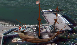
The best part of the whole adventure was when students zoomed in on the Mayflower 2 with the 3D building layer at the ground level view. Being able to spin and interact with the model of the ship gave them more insight into this historic vessel and what it must have been like to travel on it.
Lesson Two: Town Centers
The teacher and I chose five Massachusetts’ town centers for third graders to visit. This lesson took a little more preparation as exact views were chosen for students to observe.
 A folder was created in Google Earth containing each of these five stops. Students double clicked on each of the placemarks in the folder in order to fly to the locations. Once at the locations, students wrote down three things that they observed about the town center. The views included aerial as well as street level views where the students could “drive” through the commons. Students were given about 5 minutes per stop to make observations. The goal was for students to begin to see patterns in town centers and to use this information as they drew their own Puritan town. (If you’d like to try out our town center tour, please download the MA Town Centers KMZ file. You will need to have Google Earth installed on your computer.)
In both lessons, students had a specific purpose and task, and they were given strategies if they got off-track. If students zoomed off-course or became disoriented, they would click on the search button (Pilgrims) or double click on the placemark in the folder that never disappeared in their My Places (Town Centers). This simple act righted students and kept confusion and chaos out of the lesson.
Therefore, we were left with two lessons that allowed students to take field trips without leaving their school. Moreover, the lessons were engaging and extremely hands-on. A great tool to use with third graders. I’m excited about the future possibilities.
Want to know more about the basics? Start here with these great video tutorials from Google.

Loved the tour. I didn’t think Templeton even had a common. The kids must have enjoyed this activity as much as I did watching it.
Thanks, Cathy! You would have thought that we were actually getting hot fudge sundaes from the Ice Cream Barn in Templeton! They oohed and ahhed over all the sights! 🙂